'Cyclone' Akvan Takes Shape: How Close Is the Bay of Bengal Storm to India's East Coast?
Depression to Intensify into Cyclone Akvan: IMD forecasts heavy rain in Chennai, nearby Tamil Nadu districts from November 17; system moves toward Andhra Pradesh.
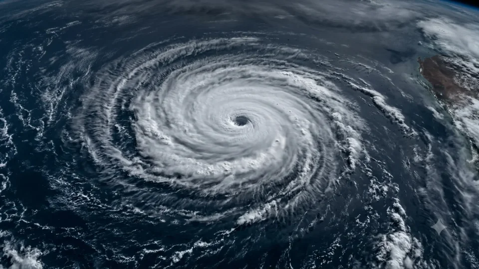
A deep depression over the southeast and adjoining southwest Bay of Bengal is likely to intensify into a severe cyclonic storm, named Akvan, by Monday (November 16) evening, bringing heavy rainfall to Chennai and nearby districts from November 17, as per the Indian Meteorological Department (IMD) forecast. The system is expected to move toward the Andhra Pradesh coast and could intensify into a very severe cyclonic storm by the night of November 19.
Yellow Alert: Pre-Cyclone Watch for Andhra Pradesh & adjoining South Odisha coast has been declared, and heavy rains in Chennai Districts are forecast.
Deep Depression over Southeast & adjoining Southwest Bay of Bengal [Pre Cyclone Watch for Andhra Pradesh & adjoining South Odisha coast Yellow Message] The Deep Depression over Southeast & adjoining Southwest Bay of Bengal moved north-northwestwards with the speed of 08 kmph during past 06 hours and lay centered at 0530 hours IST of today, the 16th November, 2026 over the same region, near Latitude 11.0°N and Longitude 86.5°E, about 630 km east-northeast of Trincomalee (Sri Lanka), 680km west of Sri Vijaya Puram (Andaman & Nicobar Islands), 720 km east-southeast of Chennai (Tamil Nadu), 820 km south-southeast of Visakhapatnam (Andhra Pradesh) and 940 km south of Gopalpur (Odisha). It is very likely to continue to move north-northwestwards, intensify further into a Cyclonic Storm over the central parts of south & adjoining westcentral Bay of Bengal in the evening of 16th November and into a Severe Cyclonic Storm over westcentral Bay of Bengal in the evening of 17th November, 2026. Thereafter, it is likely to intensify further and move northwestwards and reach over westcentral Bay of Bengal near Andhra Pradesh coast around night of 19th November 2026 as a very severe cyclonic storm.
— India Meteorological Department (@Indiametdept) November 16, 2026
Rain and Wind Warning
Heavy rain, thunderstorms, lightning and gusty winds of 40-50 kmph are likely in Chennai, Tiruvallur and Chengalpattu districts from November 17. Heavy showers are also expected in Kanchipuram, Ranipet, Tiruvannamalai, Villupuram, Cuddalore and Mayiladuthurai districts, as well as Puducherry, from November 18.
Sea Advisory
The weather office has advised fishermen from Tamil Nadu’s coastal areas not to venture into the sea from November 16 to 21, as conditions over the Bay of Bengal are expected to deteriorate.
“Fishermen are advised not to venture into Andaman Sea and along & off Andaman & Nicobar Islands, Southeast Bay of Bengal from till 17th November; Southwest Bay of Bengal during 16th – 19th November; Central Bay of Bengal during 16th – 20th November; Northwest Bay of Bengal during 19th - 20th November,” issued warning for fishermen by the IMD.
System’s Path and Where is it Heading
Recent Status and Location
On the late night of November 15, the system was moving north-northwest slowly at 8 km/h. Its centre was located over the southeast and adjoining southwest Bay of Bengal, roughly:
-
640 km east-northeast of Trincomalee, Sri Lanka
-
670 km west of Sri Vijaya Puram, Andaman & Nicobar Islands
-
760 km east-southeast of Chennai, Tamil Nadu
-
870 km south-southeast of Visakhapatnam, Andhra Pradesh
-
980 km south-southeast of Gopalpur, Odisha
Forecast and Track
-
November 16 (Evening): The system is expected to keep moving north-northwest and strengthen into a Cyclonic Storm over the central and west-central parts of the south Bay of Bengal.
-
November 17 (Evening): It is projected to intensify further into a Severe Cyclonic Storm over the west-central Bay of Bengal.
-
November 18–19: Over the following two days, the storm is likely to strengthen while shifting northwestward directly toward the Andhra Pradesh coast.
▪️దక్షిణమధ్య,పశ్చిమమధ్య బంగాళాఖాతంలో సాయంత్రానికి తుపానుగా బలపడే అవకాశం ▪️రేపు పశ్చిమమధ్య బంగాళాఖాతంలో తీవ్రతుపానుగా మారే అవకాశం ▪️ఆ తదుపరి 48గంటల్లో అతి తీవ్ర తుపాన్ గా కోస్తాంధ్ర తీర ప్రాంతానికి చేరుకునే అవకాశం ▪️మత్స్యకారులు సముద్రంలో వేటకు వెళ్ళరాదు
— Andhra Pradesh State Disaster Management Authority (@APSDMA) November 16, 2026